")
")
Technology for anglers
and water sports enthusiasts

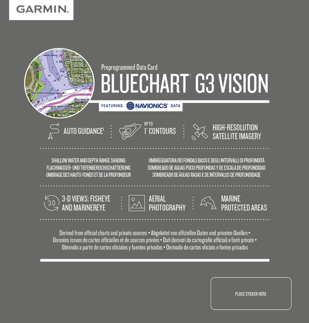
Technology for anglers Navigation GARMIN BlueChart BlueChart g3 Vision BlueChart g3 Vision HD Regular Garmin BlueChart g3 Vision VEU060R
Garmin BlueChart g3 Vision VEU060R
Product no.: 010-C1103-00
In stock
can be shipped within 3-7 days
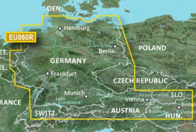
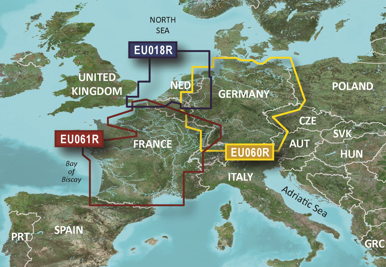
Garmin BlueChart g3 Vision VEU060R Germany Inland
Technical details:
- Comprehensive coverage, clarity and level of detail with updated nautical charts that combine Garmin and Navionics data
- Auto Guidance1 to quickly calculate suggested routes using the desired depth and usable height
- Depth range shading for up to 10 depth ranges for better recognition of the target depth
- Depth lines of up to 30 cm (1 foot) for a precise representation of the water bottom representation and optimal fishing cards
- For better visibility of shallow water areas to be avoided, you can shade this shallow water area yourself
Rely on optimal coverage and clear details on your boat tours. BlueChart® g3 cards offer unprecedented coverage and details that combine Garmin and Navionics® data.
Suggested route
Whether fishing, cruising, or sailing - pick a point and get a route that shows the general course and nearby obstacles at a safe depth1.
Suggested route
Whether fishing, cruising, or sailing - pick a point and get a route that shows the general course and nearby obstacles at a safe depth1.

Depth range shading
This shows high-resolution depth range shades for up to 10 depth ranges for better recognition of your target depth

Flat water shading
For better visibility of shallow water areas to be avoided, you can shade this shallow water area yourself
Detailed depth lines
Depth lines of up to 30 cm (1 foot) for a precise representation of the water bottom representation and optimal fishing cards. The result is optimized fishing cards and additional details in lakes, canals and ports.

High-resolution Satellite Imagery
High-resolution satellite imagery with navigational charts overlaid gives you a realistic view of your surroundings. It’s our most realistic charting display in a chartplotter — ideal for entering unfamiliar harbors or ports.

FishEye View
This underwater perspective shows 3-D representation of bottom and contours as seen from below the waterline. Interface with sonar data for a customized view.

MarinerEye View
This view provides a 3-D representation of the surrounding area both above and below the waterline.

Aerial Photography
Crystal-clear aerial photography shows exceptional detail of many ports, harbors and marinas and is ideal when entering unfamiliar ports.

1 Auto Guidance is for planning purposes only and does not replace measures for safe navigation. Auto Guidance is not included in pre-installed BlueChart g3 cards for ECHOMAP ™ Plus series chartplotters.
Scope of delivery:
- GARMIN BlueChart VEU060R (Germany Inland)
Customers who bought this product also bought
 |
 |
 |
Prices including 19% VAT, plus shipping
Browse this category: BlueChart g3 Vision HD Regular
Technology for anglers | About us | Payment methods
|