")
")
Technology for anglers
and water sports enthusiasts

Technology for anglers Navigation GARMIN BlueChart BlueChart g3 Vision BlueChart g3 Vision Small GARMIN VEU452S Bluechart g3 Vision Adriatic North Coast
GARMIN VEU452S Bluechart g3 Vision Adriatic North Coast
Product no.: 010-C0796-00
In stock
can be shipped within 3-7 days
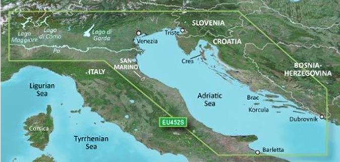
GARMIN VEU452S Bluechart g3 Vision HD Adriatic North Coast
Proposed Route
Whether fishing, sailing or cruising the motorboat - select a destination and get a route that shows the route at a safe depth and at the same time points to shoals in the vicinity.

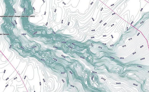
Depth Rage Shading
View high-resolution depth-of-range shades for up to 10 different depths so you can see your set target depth at a glance.

Shallow Water Shading
Shadow a set depth and get an accurate picture of shoals you want to avoid.

Detailed depth lines
BlueChart g3 Vision nautical charts display depth lines of up to 30 cm (1 foot). So you get an exact representation of the soil structures, optimized fishing permits and additional details for canals and harbor entrances.

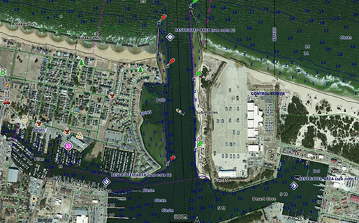
Satellite Images
High-resolution satellite imagery will be displayed in your navigation charts, giving you a realistic picture of your surroundings - a great help when entering unknown harbors.

Fisheye View
This underwater perspective gives you a 3D view from the waterline down towards the bottom. Add sonar data to get a custom view.

Mariners' Eye View
This view gives you a 3D view of the environment - both above and below the waterline.

Aerial
Crisp aerial photographs provide excellent details of many ports and marinas. They are particularly suitable when entering unknown ports.

Card size: micro SD Card + SD Card Adapter
Attention, please note:
When ordering electronic charts a return is impossible.
These charts are made by GARMIN exclusively for the customer.
Compatibility only with Garmin devices.
Delivery:
- GARMIN VEU452S Bluechart g3 Vision HD Adriatic Coast micro SD/SD card
Do you have a question?
Technology for anglers | About us | Payment methods
|