")
")
Technology for anglers
and water sports enthusiasts

Technology for anglers Navigation Navionics + Plus NAVIONICS+ Large Navionics+ Plus Large
| 1 Result |
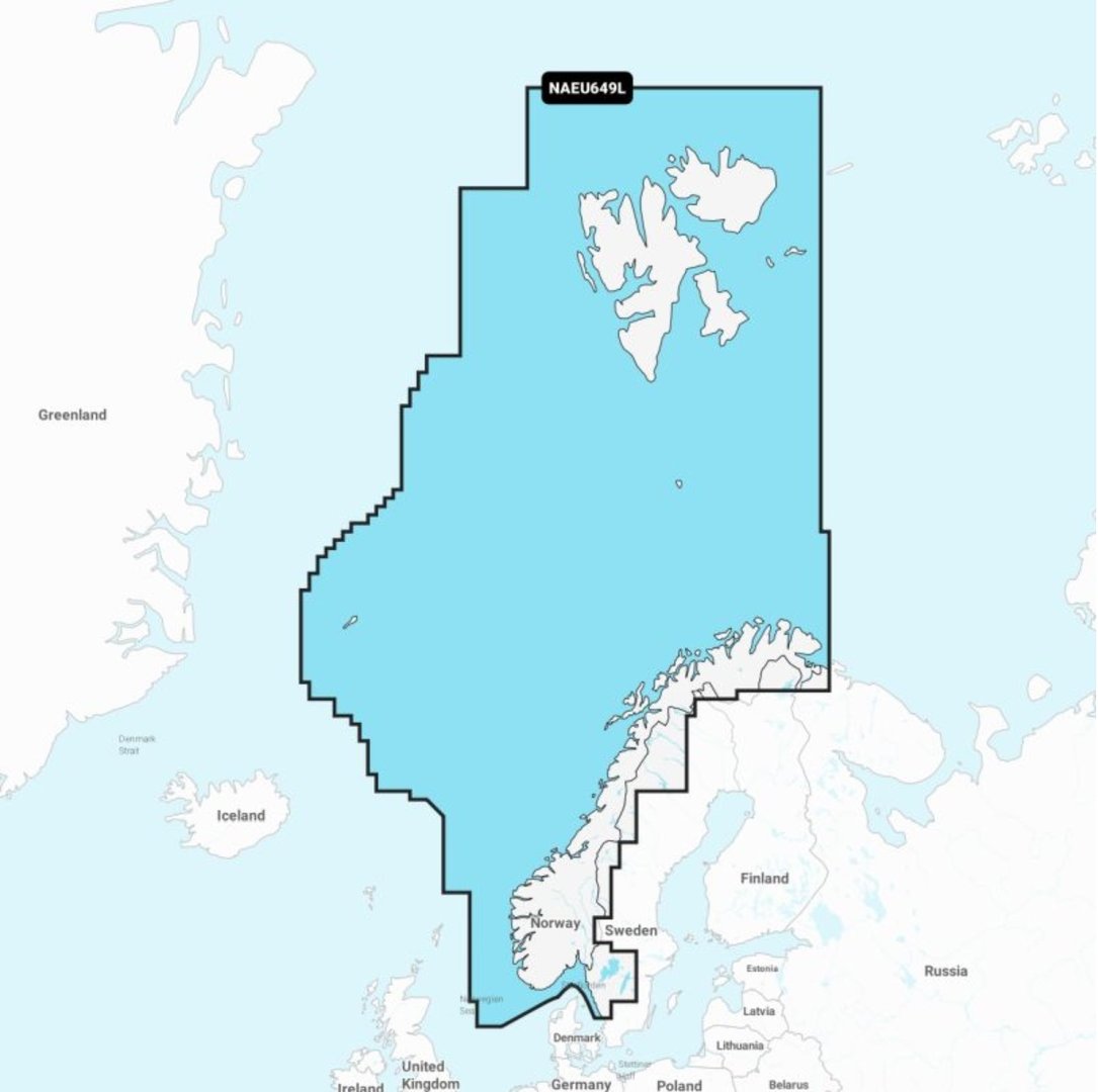
Navionics+ Plus Large
Product no.: 010-C1355-30
In stock
can be shipped within 3-7 days
Navionics+ Plus Large
and you know every body of water like the back of your hand.
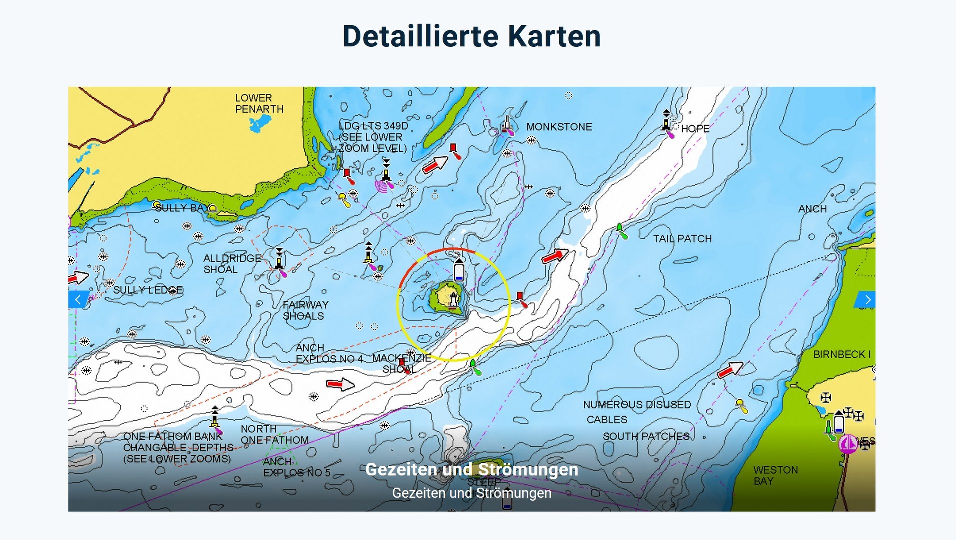
Navionics charts have been among the best digital water charts for more than 30 years. You can see for yourself why that is.
The Plus Large map of your desired area is already installed, including the ingenious SonarCharts function for the most up-to-date and most detailed depth maps. An additional download is not necessary. You will receive a ready-made micro/SD card, including an adapter, that is compatible with almost every modern sonar and chartplotter.

- With Navionics+ we combine the best of our Garmin and Navionics® technologies and data. The result: Cartography superior in coverage, clarity and detail in the proven Navionics design.
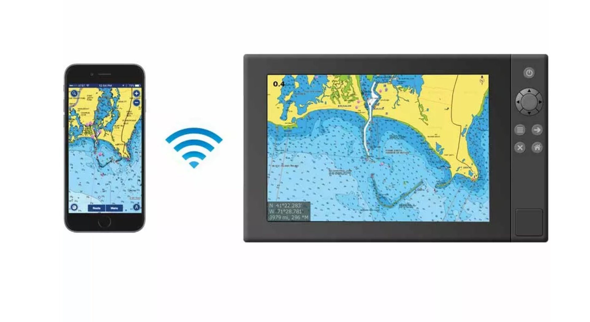
- Access to daily map updates in just a few simple steps. This can be done via the Navionics® Chart Installer software or wirelessly using Plotter Sync from the Navionics Boating App5.
- Navionics® Dock-to-Dock Autorouting4 calculates a customized suggested route for you. This is based on your own boat settings, map data and frequently traveled routes.
- Enhance your charts with community edits and trust the Navionics Boating App Community for insider tips on the local environment
- SonarChart™ HD bathymetric charts with depth contours of up to 50 cm give you a more accurate representation of bottom structures, making fishing and navigating on board much easier.
- Advanced fishing-specific features allow you to set a custom target depth.
- Thanks to shallow water shading with individually definable depth information, you can easily avoid areas of shallow water that should be avoided.
- SonarChart™ Live creates new HD bathymetric maps in real-time with depth contours up to 50 cm as you cruise the water.
- Worldwide coverage available
- Available on MicroSD™ cards; Map updates are included in the annually renewable map subscription, with the first year's updates already included with the map purchase.

Freshest Data - red hot for one year
Here you will always get the most accurate and up-to-date data. This is ensured by up to 5,000 map updates every day.
An annual subscription for the daily map updates is already included in the scope of delivery. This gives you free access to constantly updated SonarCharts, cartographic details and community edits for a year. There are also recommendations for berths and other local information from the millions of app users.
All you have to do: Activate your subscription online on the Navionics website within 2 months of purchase.

Wherever you go - with this water map you will find your way
Navionics charts have been among the leading digital water charts for over 30 years. Tides, currents, bottom, rocks, wrecks, port plans, information on sea services, restricted zones and lots of safety-related information, navigation aids such as buoys and beacon sectors and much more. Extensive and accurate information about seas, rivers and lakes can be found right here. Constantly augmented with data from numerous highly qualified public and private sources, including our surveys, Notices to Mariners and user-reported data.
Click here to get your wish card
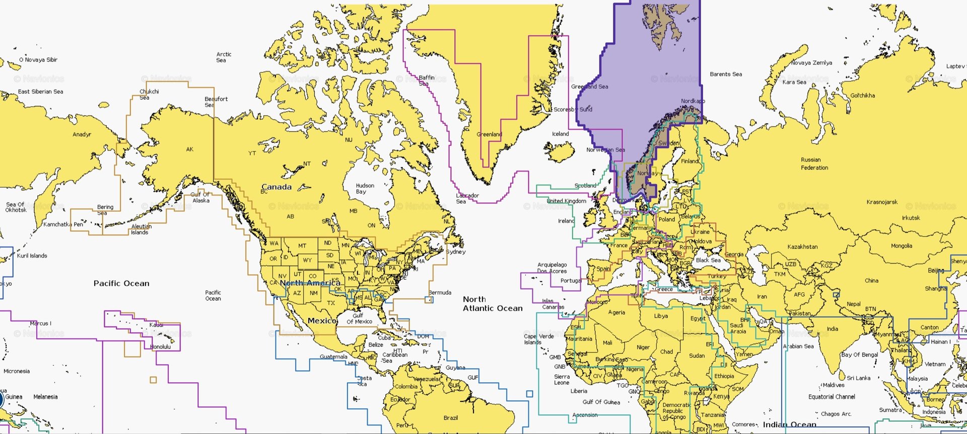
Simply select your desired region from the drop-down menu before ordering.
Your desired region is not included in our overview? We have listed the most common regular areas. Of course, we provide you with the maps of all regions worldwide - and therefore also have more exotic regions such as Taiwan, Java and Borneo or the Marshall Islands ready for you.
You need an exotic region, more information or have questions about compatibility?
Write us an email or just give us a call!
From 2022, the Navionics nautical charts will only be available on microSD cards. Navionics charts on CompactFlash for certain older plotters can only be specially adapted on request at an additional cost.
Scope of delivery:
- Navionics+ Plus Large
Customers who bought this product also bought
 |
 |
Prices including 19% VAT, plus shipping
Browse this category: NAVIONICS+ Large
| 1 Result |
Technology for anglers | About us | Payment methods
|