")
")
Technology for anglers
and water sports enthusiasts

Technology for anglers Navigation C-MAP C-MAP 4D Nautical chart C-MAP 4D Local
Nautical chart C-MAP 4D Local
Product no.: EN-D068
In stock
can be shipped within 3-7 days
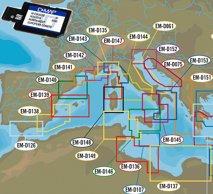
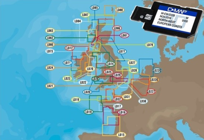
Nautical chart C-MAP 4D Local
C-MAP 4D is a "bespoke" electronic mapping concept that gives boaters unparalleled control over their navigation in coastal, canal and inland waters.
All details and functions combined in one inexpensive nautical chart: C-MAP MAX-N + Local charts
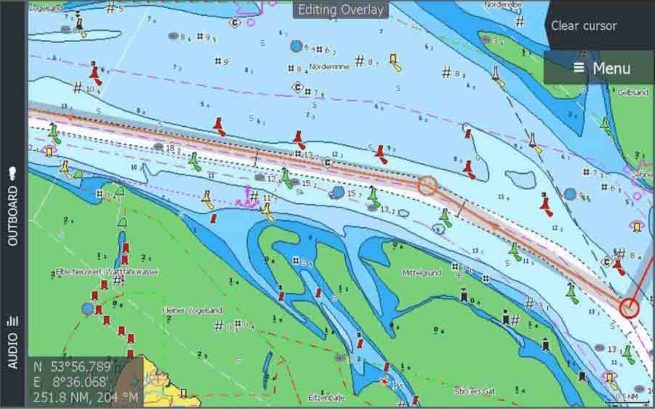
C-MAP MAX-N + Local cards are just right for you if you need a little coverage. But do not want to do without the full range of functions. This is included with the C-MAP MAX-N + Local cards. So you get all the functions and details as with all C-MAP MAX-N + nautical charts, just a smaller area coverage. Includes 12 months of free updates. The advantage: a particularly low price. Incidentally, you get the MAX-N + card as a micro SD card including an SD card adapter and are therefore flexible with different devices. C-MAP MAX-N + Local nautical charts offer you as a sailor with dynamic raster maps the complete program of all relevant information. As an angler, you benefit from high-resolution bathymetry maps (HRB). Tide & current projections help all users and boaters. In addition, there are a lot of other very interesting and useful functions: Functions and advantages of the C-MAP MAX-N + Local cards Complete Vector Maps: Make it easy for you to navigate with accurate, up-to-date vector map details derived from information from the official hydrographic office. Individual depth shading: The custom depth shading offers you a lot of options. You can set a color to warn you when you're out of your safe depth, use a traditional paper-like view, or create your own custom palette. C-MAP Genesis Layer: Adds 1 foot deep contours to the official maps compiled from the Genesis Social mapping. Hi-Res Bathymetry Layer: Essential for anglers. HRB will help you identify shallow areas, drop-offs, ledges, holes and bumps on the sea, river or lake floor. Easy Routing: Automatically shows the shortest and safest route based on detailed map data and your entered ship information. Tides and Currents: Shows the direction and strength of tides and the water level to help you plan your fishing day or trip. C-MAP App-Sync: Synchronizes the data in the app. Detailed Port Maps: Shows you improved details when you enter port - ideal for cruising in lesser-known areas Shaded Relief: Brings the world around your boat to life with 3D rendered land and underwater elevation Dynamic Raster Charts: With the traditional look and feel of charts, coupled with easy access to all key elements of chart data Satellite overlay: Overlay satellite images to give you even more information about your surroundings when you are in an unknown location. Aerial Photos: Created from thousands of photos of marinas, harbors, bays, and other key areas. You can even overlay aerial photos to see an extra layer of detail.
Scope of delivery:
- Nautical chart C-MAP 4D Local depending on the selection
Technology for anglers | About us | Payment methods
|