")
")
Technology for anglers
and water sports enthusiasts

Technology for anglers Navigation Navionics + Plus NAVIONICS+ Regular Navionics+ bare
Navionics+ bare
Product no.: 598102
In stock
can be shipped within 3-7 days
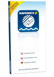
Navionics+ Plus chart
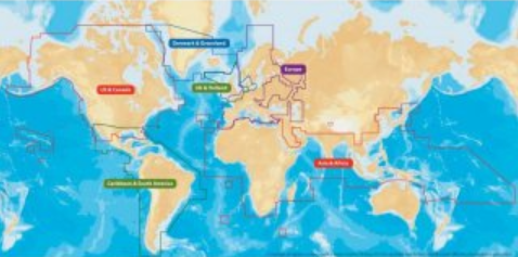
Usual charts are prerecorded usually with a particular region. You decide yourself for a XL9 region.
You will receive a special blank, you can record on your home PC with your favorite region. Corresponds e.g. a 46XG, 45XG, etc.
Unlike normal charts from Navionics, the additional sonar charts.
However, this requires a fast Internet connection, because you home the cards with the information you need to record only.
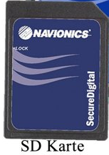
This version is the MicroSD with SD Card Adapter
Click HERE for the WebApp Navionics, which allows you to view your region before.
Features and features of the Naviocs + Small nautical charts

Freshest Data
As a user of an electronic Navionics Plus nautical chart, you can use the most current map material at all. More than 2000 updates a day keep Navionics Plus nautical charts up to date. In addition to the essential cartographic reference details of the nautical chart itself, the updates also concern community edits - the local information and inputs made by millions of Navionics app users - and before especially the SonarCharts, which are real bathymetric HD depth maps for fishing. Users who register their Navionics Plus card on the Navionics website within two months of purchase can use Freshest Data as a free service for a whole year, whenever and as often as they want!

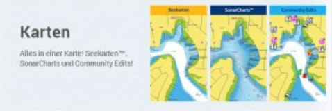
Community Edits
With community edits, millions of users of the Navionics app are constantly improving the map material. Every user has the right to make changes and corrections.
The information gain is enormous: Get information about particularly catchy fishing spots, slip points, boat ramps, ports (even restaurants and shops) and of course seasonal changes regarding buoys, beacon sectors, rocks, wrecks and much more.
Although the Community Edits can only be entered by Apple and Android app users, they are also available on your sonar. All you have to do is activate the corresponding overlay in the chart view of your sonar.

Navionics Charts
The nautical chart view contains the most comprehensive and accurate information about seas, lakes and rivers that has ever been created. Navionics nautical charts really contain everything that is necessary for safe navigation and fishing. For example, depth lines, tides, currents, substrate information, wrecks, rocks, harbor maps, information about maritime services, navigation aids such as buoys and beacon sectors and much more. This data is not only continuously expanded, but also qualitatively and quantitatively improved. Numerous highly qualified data sources such as authorities or Navionics' own collections around the world have guaranteed the best digital nautical charts for more than 30 years.

Navionics SonarChart
Navionics SonarCharts are real, bathymetric HD maps that display incredibly accurate and detailed depth lines. This makes them the perfect tool for anglers, because when it comes to fishing, it is important to find small channels or edges that are otherwise not found on any nautical chart. And of course it is important to have absolutely up-to-date depth maps, because currents and waves can often drastically change waters within a few years. SonarCharts from Navionics offer all of this. How it works? Quite simply: You simply load the SonarChart data onto your Navionics map (the Freshest Data Service is recommended), activate SonarChart as an overlay in your chart view on the sounder and you benefit from incredibly detailed depth maps. Create more SonarCharts like thousands of other SonarChart users. Simply start an echo sounder recording, load the data onto the Navionic server and after a short time you will receive a notification that the map is available for download. This is exactly the principle of the SonarChart Community: You access the SonarChart data of all other anglers and at the same time provide your own data. So you benefit from impressively current and detailed depth maps, which are optimal for every angler.
Special feature:
So you can participate in the sonar chart program with which you still get accurate depth information especially for fishing.
Compatible with all combi tools that can read charts the normal gold.
These maps should register at least two months after the purchase Navionics to be admitted to the Freshest Data program to update the map. Then you will get the latest map updates for 12 months.
If you have technical questions about your computer in conjunction with the Navionics chart can help Technical Support Navionics. This speaks German and usually helps quickly and efficiently.
Card size: micro SD Card + SD Adapter or CF (Compact Flash)
Do you have a question?
Technology for anglers | About us | Payment methods
|