")
")
Technology for anglers
and water sports enthusiasts

Technology for anglers Navigation create your own navigation map ReefMaster 2.0 software
ReefMaster 2.0 software
Product no.: 200011
can be shipped within 1-2 days
Reefmaster 2.0 Software
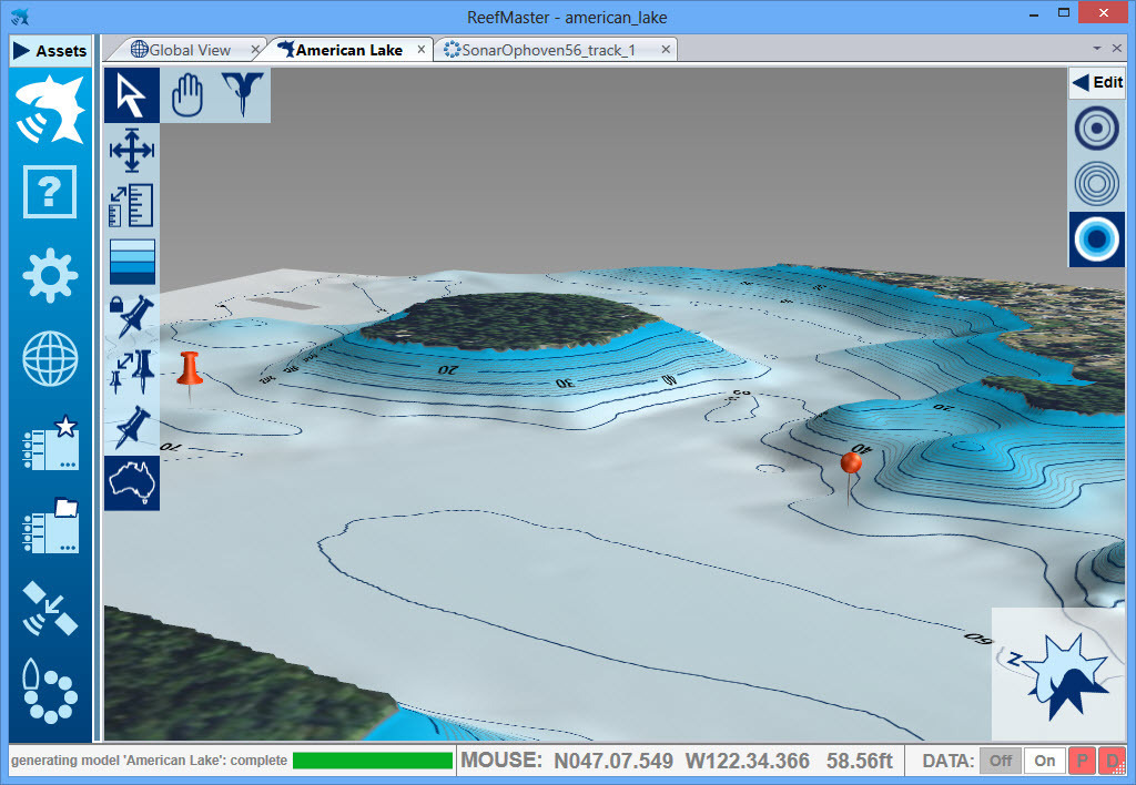
is a Windows PC application that uses data from sonar log files to create 3D underwater charts, combined with a multi-channel sonar viewer and graphical waypoint management. With underwater mapping, you create contour maps from sonar log files and view them in 2D and 3D with a range of basemap options. Save maps for use on your GPS device. Multi-channel sonar viewer Multi-channel sonar viewer for Lowrance and Humminbird sonar log files, including support for the latest Humminbird sonars. Waypoint Management - View and edit waypoints from a world basemap, with support for multiple waypoint sets. Load and save waypoints in different file formats.

Flexible data import/export
- Combine chart data from a variety of sources including native Lowrance and Humminbird sonar logs, GPX files, NMEA 0183, shapefile and CSV files.
Export maps in a range of formats including:
- Navico AT5 for compatibility with a wide range of Lowrance devices, new and old.
- Full vector maps in Google Earth for use on tablets and smartphones.
- ESRI Shapefile for use in a variety of GIS applications.
- High resolution image files and MBTiles.
Technical details:
underwater mapping
The echo sounder on your boat recognizes how deep the water is below you. Your GPS knows where you are. ReefMaster combines this depth and position data to create a highly detailed underwater map.
- Create contour maps from sonar log files and display them in 2D and 3D with a range of basemap options.
- Combine chart data from a variety of sources including native Lowrance and Humminbird sonar logs, GPX files, NMEA 0183, ESRI shapefiles and text files.
- Create sea or lake bottom hardness maps with the optional Soil Composition add-on module.
- Calculate water quantities with the optional volume and area add-on module.
- Create waypoints using drag & drop in both 2D and 3D map views.
- View and export maps in a number of predefined palettes or create your own color scheme.
- Adjustable contour intervals in metric or US units
Create real-time charts with NMEA 0183 data:
- Log depth and position data via NMEA 0183.
- Create maps in real time with a split screen display (live track/map).
- Receive GPS and depth from up to two separate NMEA sources with adjustable latency.
- Display live boat position on any ReefMaster screen
Save your maps in a range of formats including:
- One-click export for a range of preset Lowrance and Google Earth map styles
- Generate stunning AT5 vector maps or shaded relief maps for Lowrance and Simrad GPS devices
- Create contour maps as track files for viewing on Humminbird devices
- Export full-color Google Earth contour maps in KML format for viewing in Google Earth and mobile devices
- Store georeferenced, high-resolution map images for use in documents and websites
- Store contour maps in ESRI shapefile format and 3D bathymetry in ESRI raster format for use in other GIS applications
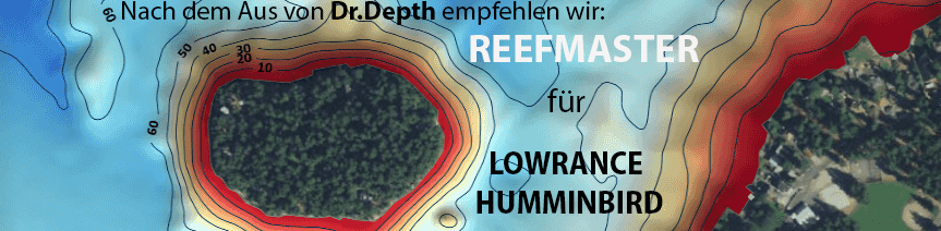
Examples of Lowrance, Google Earth and Imagemap exports:


Multi-channel sonar viewer
- Compatible with Humminbird and Lowrance sonar log files
- Multi-channel split-screen display with smooth playback up to 30x
- Adjustable brightness, contrast and color palettes
- Create waypoints in the sonar viewer
- Measure the distance and estimate the object's height or depth based on the length of the shadow
- Adjust track point depths in the Sonar Viewer to correct bottom-lock errors
Track management
- Store your past tracks in ReefMaster, with easy access via the asset library
- View tracks over basemaps of the world
- Crop, split and merge tracks and save the results back to your GPS device
- Adjust track point depths for lake level or tide fluctuations
- Log data from NMEA data sources
- Export raw track data in a range of formats, including comma-delimited text files for use in other GIS applications
Scope of delivery:
- ReefMaster 2.0 is a downloadable product. Once you have completed the purchase and get paid you have the license key, which raises the free herundterladbare trial to the full version
- For further inquiries we are happy to help
- The software is in English but very easy to use
Attention: Prices on reefmaster.com.eu are listed without VAT. With us you have German support and a very good price too.
Customers who bought this product also bought
 |
 |
 |
 |
Prices including 19% VAT, plus shipping
Browse this category: Produce your own charts
Technology for anglers | About us | Payment methods
|