")
")
Technology for anglers
and water sports enthusiasts

Technology for anglers Navigation create your own navigation map Update ReefMaster Pro from 1.8 to 2.0
Update ReefMaster Pro from 1.8 to 2.0
Product no.: 200006
In stock
can be shipped within 2-4 days
Update ReefMaster Pro from 1.8 to 2.0
How do I update?
- ReefMaster 2 will be installed side-by-side with ReefMaster v1 in a 14-day trial period. ReefMaster 2 can be downloaded. You will receive the link from us.
- If you have installed a ReefMaster v1 installation, make sure it has been updated to the latest version (1.8.41 or later) before installing ReefMaster 2.
- Existing users of ReefMaster v1 can upgrade to ReefMaster 2. Any existing additional modules will be retained during the upgrade process and ReefMaster 1 can continue to be used in parallel as needed.
- Upgrading to ReefMaster 2 can be purchased via an in-app upgrade button if an existing ReefMaster v1 key exists.
- New users please buy the ReefMaster 2 full version.
- The ReefMaster LITE Edition has been discontinued and ReefMaster 2 loses the PRO name to simply become "ReefMaster".
Buy this product, send us your license key and we will have it transformed by the manufacturer.
See what you've been missing
|
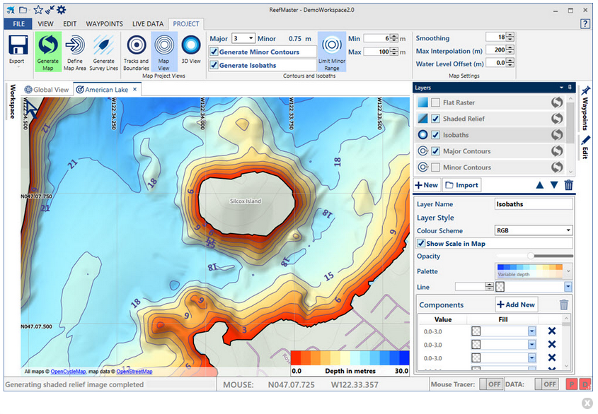
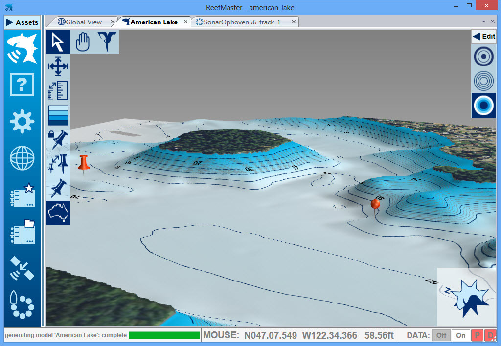
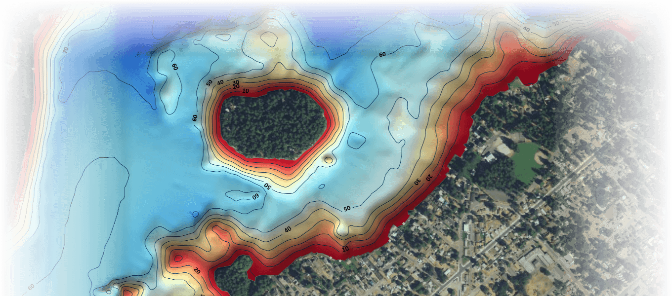
Underwater Mapping |
|
|
Sidescan Mosaic |
|
|
Waypoint Management |
|
|
Multi-channel Sonar Viewer |
|
| |
Flexible Data Import/Export • Combine mapping data from a wide range of sources, including native Lowrance and Humminbird sonar logs, GPX files, NMEA 0183, Shapefile and CSV files. Export maps in a range of formats, including: • Navico AT5 for compatibility with a wide range of Lowrance devices, new and old. • Full vector maps in Google Earth for use on tablets and smart-phones. • ESRI Shapefile for use in a wide range of GIS applications. • High resolution image files and MBTiles. |
Technology for anglers | About us | Payment methods
|