")
")
Technology for anglers
and water sports enthusiasts

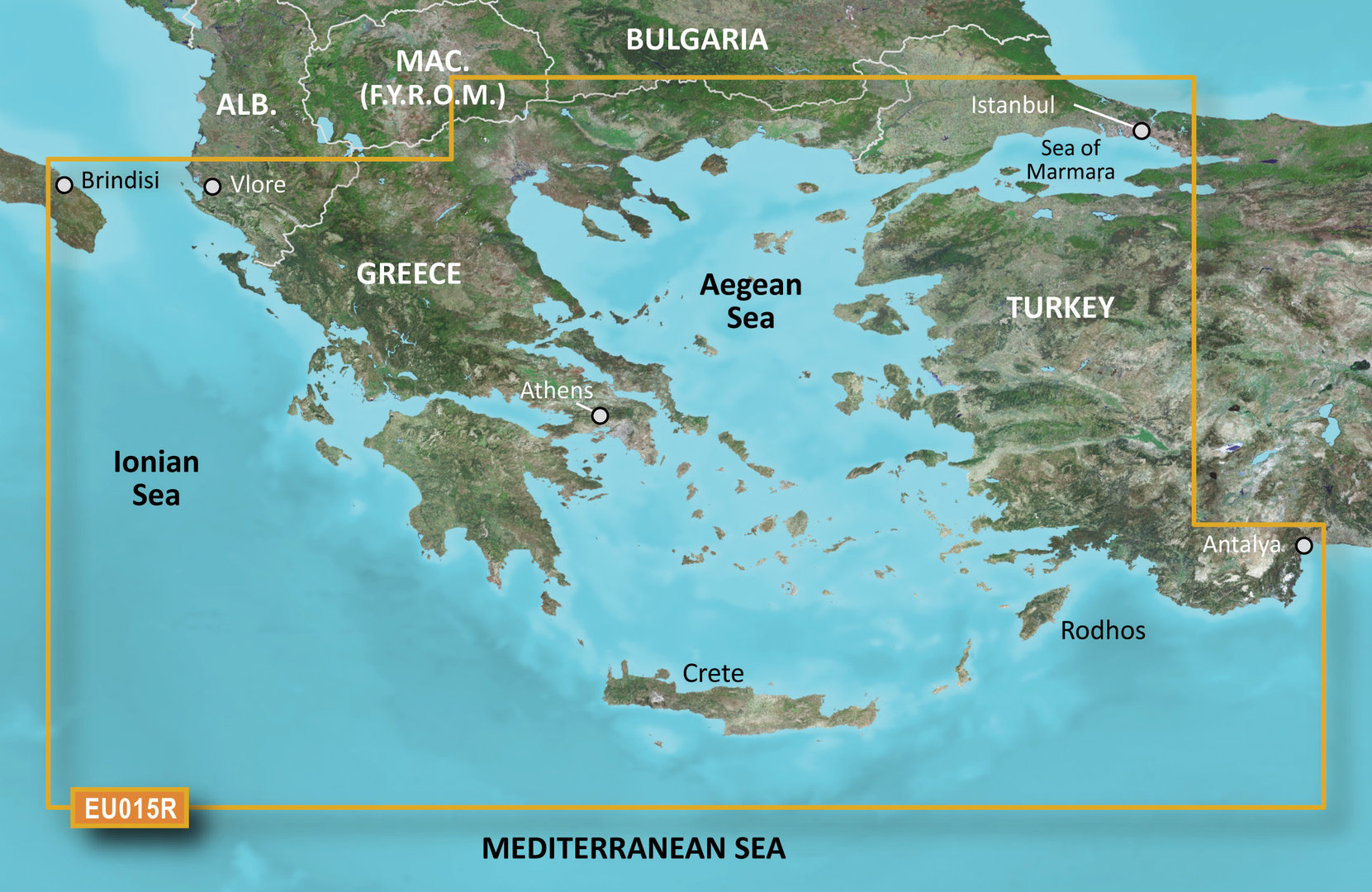
Technology for anglers Navigation GARMIN BlueChart Garmin BlueChart g3 BlueChart g3 HXEU015R Aegean Sea & Sea of Marmara
BlueChart g3 HXEU015R Aegean Sea & Sea of Marmara
Product no.: 010-C0773-20
In stock
can be shipped within 3-7 days
GARMIN g3 BlueChart HXEU015R - Aegean Sea & Sea of Marmara
Technical details:
- Comprehensive coverage, clarity and level of detail with updated nautical charts that combine Garmin and Navionics data
- Auto Guidance1 to quickly calculate suggested routes using the desired depth and usable height
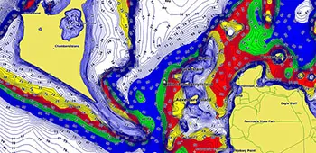
- Depth range shading for up to 10 depth ranges for better recognition of the target depth
- Depth lines of up to 30 cm (1 foot) for a precise representation of the water bottom representation and optimal fishing cards
- For better visibility of shallow water areas to be avoided, you can shade this shallow water area yourself
Rely on optimal coverage and clear details on your boat tours. BlueChart® g3 cards offer unprecedented coverage and details that combine Garmin and Navionics® data.
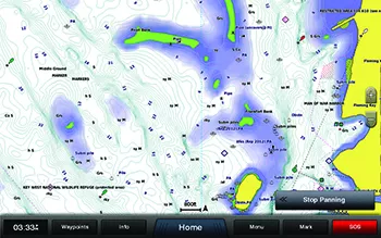
Suggested route
Whether fishing, cruising, or sailing - pick a point and get a route that shows the general course and nearby obstacles at a safe depth1.
Suggested route
Whether fishing, cruising, or sailing - pick a point and get a route that shows the general course and nearby obstacles at a safe depth1.

Depth range shading
This shows high-resolution depth range shades for up to 10 depth ranges for better recognition of your target depth

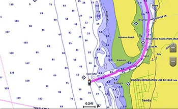
Flat water shading
For better visibility of shallow water areas to be avoided, you can shade this shallow water area yourself
Detailed depth lines
Depth lines of up to 30 cm (1 foot) for a precise representation of the water bottom representation and optimal fishing cards. The result is optimized fishing cards and additional details in lakes, canals and ports.
1 Auto Guidance is for planning purposes only and does not replace measures for safe navigation. Auto Guidance is not included in pre-installed BlueChart g3 cards for ECHOMAP ™ Plus series chartplotters.
Continental coverage: Including all of the Greek coast and Aegean Sea; Turkey from Istanbul and Sea of Marmara to Antalya; and Brindisi, Italy.
Scope of delivery:
- GARMIN BlueChart HXEU015R (Aegean Sea & Sea of Marmara)
Technology for anglers | About us | Payment methods
|