")
")
Technology for anglers
and water sports enthusiasts

Technology for anglers Navigation Navionics + Plus Navionics+ Gold XL9 49XG preloaded
Navionics+ Gold XL9 49XG preloaded
Product no.: 1054–30769
In stock
can be shipped within 3-7 days
Navionics+ Gold XL9 49XG preloaded (pre-installed)
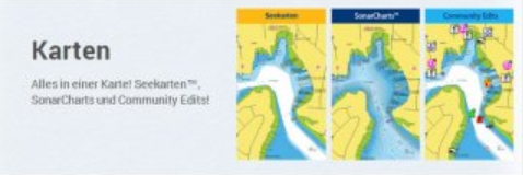
The XL9 maps cover but from one up to three times larger area. They do not cost more than the XL3 cards. The vectorized XL9 cards are designed with the Navionics own seamless technology. For this reason, they are on every zoom level of a piece and show all the information easy to read and clear.
intuitive operation
Tides & currents
By Navionics Gold card navaids become natural in form and color
Beacons, and other sectors are color coded, so that a safe driving on the fairway on the card is possible
Different water depths are shown in different colors
A safe orientation easier; good fishing spots can be identified quickly
Orientation: Heading Up or North Up or waypoint above
Non-navigable river sections are marked in dark green, making it easy to distinguish from the white fairway and deeper turquoise areas
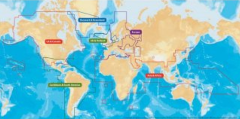
global map library for accurate navigation
so that you get by greater coverage with a module
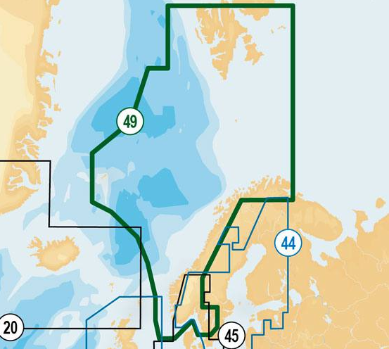
Region: Norwegian including Svalbard Islands, Shetland Islands, West Sweden Strömstad to Varberg. Vättern, Vänern and Mjøsa Lakes
Card size: micro SD Card + SD Adapter or CF (Compact Flash)
Do you have a question?
Technology for anglers | About us | Payment methods
|